




Map of Michigan Upper Peninsula: Your Complete Guide to Planning the Perfect U.P. Adventure
Michigan’s Upper Peninsula is a spectacular destination filled with waterfalls, dense forests, scenic lakeshores, rugged coastlines, and charming small towns. With so much to see across such a large area, having a map of Michigan Upper Peninsula can make planning your trip much easier. It helps you understand the distance between attractions, choose the best routes, and organise your stops more efficiently.
From the shores of Lake Superior to the forests of the western U.P., the region offers plenty of opportunities for hiking, sightseeing, road trips, and outdoor adventures. Whether you’re planning a short weekend escape or a week-long journey, understanding the map of Upper Peninsula of Michigan can help you create a practical itinerary and make the most of your time exploring this beautiful part of the Midwest.
Why You Need a Map of Michigan Upper Peninsula
A map is more than a navigation tool. It helps you visualize the region, estimate driving times, and group nearby attractions into one itinerary.
Planning with a map also reduces unnecessary backtracking, saving both time and fuel during your trip.
Easier Road Trip Planning
Many visitors underestimate the Upper Peninsula’s size. Looking at a map before your trip makes it easier to organize each day’s travel and avoid spending hours on the road.
Discover Hidden Attractions
Some of the U.P.’s best waterfalls, scenic overlooks, and beaches lie off the main highways. A detailed map helps you discover these hidden gems that GPS may not highlight.
Understand Driving Distances
Although two destinations may appear close together, winding highways and scenic roads often increase travel time. Reviewing the map in advance helps set realistic expectations.
Where Is Michigan’s Upper Peninsula?
The Upper Peninsula sits north of Michigan’s Lower Peninsula and is connected by the Mackinac Bridge. It borders Wisconsin to the southwest and is surrounded by Lake Superior, Lake Michigan, and Lake Huron.
Its unique location gives visitors access to diverse landscapes, freshwater coastlines, and outdoor recreation throughout the year.
Quick Facts About the Upper Peninsula
- Covers over 16,000 square miles
- Home to 15 counties
- More than 300 waterfalls
- Surrounded by three Great Lakes
- Over 4 million acres of public forest
- Popular for hiking, camping, kayaking, fishing, and scenic drives
These facts show why the U.P. is one of the Midwest’s premier outdoor destinations.
Understanding the Geography
The Upper Peninsula offers a remarkable variety of landscapes within a single region.
The northern shoreline features rocky cliffs and powerful waves along Lake Superior. The southern shoreline borders Lake Michigan with sandy beaches and peaceful waterfront towns. Lake Huron, on the eastern side, is known for quiet bays, islands, and historic lighthouses.
Further inland, you’ll find forests, rivers, inland lakes, wetlands, and hundreds of hiking trails.
How to Read a Map of Upper Peninsula Michigan
Before planning your route, learn how the region is divided. Most travel maps separate the Upper Peninsula into three areas:
- Eastern Upper Peninsula
- Central Upper Peninsula
- Western Upper Peninsula
Each region offers different scenery and attractions, making itinerary planning much easier.
Download Offline Maps
Cell service is limited in parts of Hiawatha National Forest, the Keweenaw Peninsula, and several state parks. Download offline maps before leaving larger towns like Marquette or St. Ignace.
Plan Fuel Stops
Gas stations can be far apart in remote areas. Filling your tank whenever it reaches half full is a smart habit while exploring the U.P.
Allow Extra Driving Time
Roads are scenic, and you’ll likely stop often for waterfalls, beaches, overlooks, and wildlife. Leave flexibility in your schedule rather than planning every hour.
Eastern Upper Peninsula
The Eastern Upper Peninsula is the gateway to the region and is often the first stop after crossing the Mackinac Bridge.
It combines beautiful waterfalls, historic landmarks, quiet beaches, and excellent outdoor recreation.
St. Ignace
St. Ignace is one of the oldest cities in Michigan and serves as the primary gateway to Mackinac Island. Visitors enjoy waterfront parks, local restaurants, museums, and ferry services.
Tahquamenon Falls State Park

Tahquamenon Falls is one of Michigan’s most famous natural attractions. The Upper Falls spans more than 200 feet and flows with amber-colored water created by natural tannins from surrounding cedar forests.
Walking trails, observation decks, canoe rentals, and picnic areas make it a perfect stop for families and photographers.
Whitefish Point
Located along Lake Superior, Whitefish Point is famous for its lighthouse and the Great Lakes Shipwreck Museum.
The area is also a popular destination for birdwatching and sunset photography.
Paradise
Despite its small size, Paradise offers lodging, restaurants, beaches, and easy access to nearby waterfalls and Whitefish Point.
Many travellers use the town as a base for exploring the eastern shoreline.
Les Cheneaux Islands
This collection of small islands offers calm waters perfect for kayaking, boating, fishing, and wildlife viewing.
The area provides a quieter alternative to more popular tourist destinations.
Central Upper Peninsula
The Central Upper Peninsula is home to many of Michigan’s most recognizable natural attractions.
It combines breathtaking scenery with welcoming towns and excellent outdoor recreation.
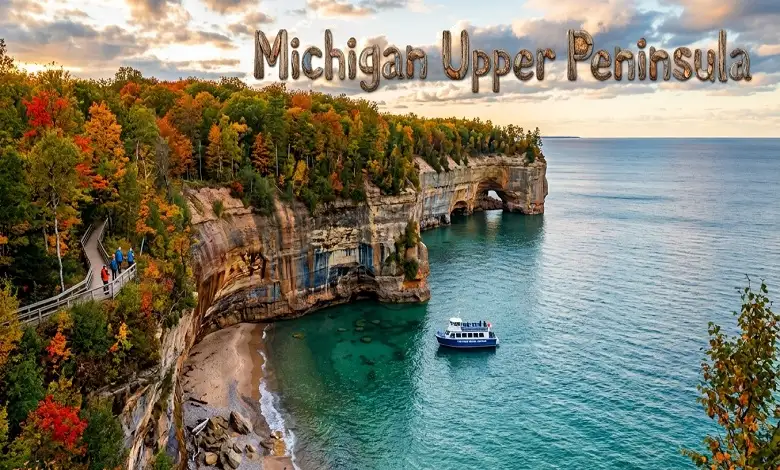
Pictured Rocks National Lakeshore
Pictured Rocks stretches for more than 40 miles along Lake Superior.
Colorful sandstone cliffs, sea caves, waterfalls, beaches, and hiking trails make it one of the most photographed places in Michigan.
Boat cruises and kayaking tours provide unforgettable views from the water.
Munising
Munising serves as the main gateway to Pictured Rocks.
The town also offers restaurants, hotels, marinas, and easy access to several famous waterfalls, including Munising Falls, Miners Falls, Wagner Falls, and Alger Falls.
Kitch-iti-Kipi
Known as Michigan’s largest freshwater spring, Kitch-iti-Kipi features crystal-clear water and a unique observation raft that glides across the spring.
Visitors can see trout, ancient tree trunks, and bubbling sand vents beneath the surface.
Marquette
Marquette is the largest city in the Upper Peninsula and one of its best places to stay.
Visitors can hike Sugarloaf Mountain, explore Presque Isle Park, relax at McCarty’s Cove Beach, shop downtown, or enjoy local breweries and fresh Lake Superior whitefish.
Why Stay in Marquette?
Marquette offers the widest selection of hotels, restaurants, grocery stores, and outdoor outfitters in the U.P.
Its central location also makes it an excellent base for exploring nearby attractions.
Major Highways to Know
Understanding the highway network makes travel much easier.
US-2: Runs along Lake Michigan and connects many southern communities.
M-28: The primary east-west highway linking Munising, Marquette, and Newberry.
US-41: Travels north to Copper Harbor through Marquette and Houghton, offering some of the U.P.’s most scenic drives.
Western Upper Peninsula
The Western Upper Peninsula is where Michigan’s rugged wilderness truly comes to life. This region is known for dense forests, dramatic overlooks, historic mining towns, and some of the best outdoor recreation in the Midwest.
Compared to the eastern side of the U.P., the western region feels quieter and more remote. It’s an excellent choice for travelers who enjoy hiking, camping, mountain biking, and scenic road trips.
Copper Harbor
Located at the northern tip of the Keweenaw Peninsula, Copper Harbor is one of the Upper Peninsula’s most picturesque destinations.
Surrounded by Lake Superior, this small town is famous for its mountain biking trails, hiking routes, kayaking opportunities, and peaceful atmosphere. It’s also one of Michigan’s best places to watch the sunrise or enjoy spectacular fall colors.
Because of its remote location, many visitors choose to spend at least one night here instead of making it a day trip.
Brockway Mountain Drive
No map of Michigan Upper Peninsula is complete without Brockway Mountain Drive.
This scenic road climbs more than 700 feet above Lake Superior and offers panoramic views of the surrounding forests, shoreline, and Copper Harbour.
The drive is especially popular during autumn when vibrant red, orange, and golden leaves blanket the landscape.
Porcupine Mountains Wilderness State Park
Known simply as the “Porkies,” this is Michigan’s largest state park.
Covering nearly 60,000 acres, it protects one of the largest remaining old-growth hardwood forests in North America.
Visitors come here to hike, camp, canoe, fish, and photograph waterfalls.
The park offers more than 90 miles of hiking trails, making it one of the best destinations for outdoor enthusiasts.
Lake of the Clouds
One of the park’s biggest highlights is Lake of the Clouds.
The overlook provides breathtaking views of the lake surrounded by rolling hills and thick forests.
During fall, this becomes one of the most photographed viewpoints in Michigan.
Sunrise and sunset are particularly beautiful here.
Houghton and Hancock
These neighbouring cities sit along the Keweenaw Waterway and offer a fascinating look at Michigan’s copper mining history.
Today, visitors can tour historic buildings, museums, local shops, and waterfront parks while learning how mining shaped the region.
The area is also home to Michigan Technological University, giving the community a lively atmosphere year-round.
Top Attractions to Mark on Your Map
If you’re creating a map of Upper Peninsula of Michigan for your road trip, these attractions deserve a place on your itinerary.
Pictured Rocks National Lakeshore: Famous for colourful cliffs, sea caves, waterfalls, and boat tours.
Tahquamenon Falls State Park: One of the largest waterfalls east of the Mississippi River.
Kitch-iti-Kipi: Michigan’s largest natural freshwater spring with crystal-clear water.
Porcupine Mountains: Perfect for hiking, camping, wildlife viewing, and fall foliage.
Whitefish Point: Visit the historic lighthouse and Great Lakes Shipwreck Museum.
Mackinac Bridge: Although technically connecting the Lower and Upper Peninsulas, crossing this five-mile suspension bridge is an unforgettable part of any U.P. adventure.
Presque Isle Park: Located in Marquette, this lakeside park features scenic cliffs, walking trails, picnic areas, and spectacular Lake Superior sunsets.
Best Scenic Drives in the Upper Peninsula
One of the greatest joys of exploring the U.P. is simply driving.
Several highways pass through forests, along lakeshores, and over rolling hills, offering incredible scenery throughout the year.
M-28 Scenic Route
M-28 connects many of the Upper Peninsula’s most famous destinations, including Munising, Marquette, and Newberry.
Along the way, you’ll pass waterfalls, forests, beaches, and wildlife viewing areas.
US-41 to Copper Harbor
This drive takes travellers through the heart of the Keweenaw Peninsula.
Expect winding roads, dense forests, historic mining towns, and breathtaking Lake Superior overlooks.
M-123
M-123 provides easy access to Tahquamenon Falls State Park, Whitefish Point, and Paradise.
It’s one of the best routes for travellers interested in waterfalls and maritime history.
Lake Michigan Shoreline Drive (US-2)
US-2 follows much of Lake Michigan’s northern shoreline.
The route offers sandy beaches, charming waterfront communities, scenic picnic areas, and beautiful sunset views.
Best Time to Visit the Upper Peninsula
Every season offers something unique.
Spring
Snowmelt creates powerful waterfalls, while forests begin to bloom with wildflowers.
Crowds remain relatively small during this season.
Summer
Summer is ideal for kayaking, hiking, camping, fishing, and boat tours.
Long daylight hours make it the busiest travel season.
Fall
Many travellers consider autumn the best time to visit.
The forests transform into brilliant shades of red, orange, and yellow, creating spectacular scenery throughout the peninsula.
Winter
The Upper Peninsula receives heavy snowfall, making it a paradise for snowmobiling, cross-country skiing, snowshoeing, and ice climbing.
Frozen waterfalls create breathtaking winter landscapes.
Practical Travel Tips
A little preparation goes a long way when exploring the U.P.
Download Offline Maps
Cell service becomes limited in remote forests and state parks.
Downloading offline maps before leaving larger towns helps avoid navigation problems.
Keep Your Fuel Tank Full
Gas stations can be far apart, especially in the western region.
Refuel whenever your tank reaches half full.
Pack for Changing Weather
Lake Superior can influence temperatures throughout the year.
Carry layers, even during summer, as mornings and evenings may be cool.
Leave Time for Scenic Stops
One of the biggest mistakes first-time visitors make is planning too many destinations in one day.
Allow extra time for overlooks, beaches, waterfalls, and unexpected photo opportunities.
Final Thoughts
A map of Michigan Upper Peninsula is much more than a navigation tool—it’s the key to discovering one of America’s most beautiful and underrated travel destinations. From the historic waterfront of St. Ignace and the thundering waters of Tahquamenon Falls to the colourful cliffs of Pictured Rocks and the remote beauty of Copper Harbor, every corner of the U.P. offers something unique.
Whether you’re using a map of Upper Peninsula of Michigan to plan a weekend escape or creating a week-long road trip itinerary, understanding the region’s layout helps you travel more efficiently and uncover places that many visitors miss. By grouping attractions, following scenic highways, and allowing time to explore beyond the main routes, you’ll experience the Upper Peninsula at its best.
The beauty of the U.P. isn’t found in a single landmark—it’s found in the journey itself. Every winding highway, quiet lakeshore, forest trail, and welcoming small town adds another memorable chapter to your adventure. With a reliable map of Upper Peninsula Michigan in hand, you’re ready to explore one of the Great Lakes region’s most remarkable landscapes.
Frequently Asked Questions
Q: How many days do you need to explore the Upper Peninsula?
A. A minimum of three days allows you to visit the most popular attractions. However, five to seven days provides a much more relaxed and rewarding experience.
Q: Is driving the best way to explore the U.P.?
A. Yes. Most attractions are spread across the region, making a personal vehicle the most convenient option.
Q: Do I need a paper map?
A. Digital navigation works well in towns, but carrying a printed map of Upper Peninsula Michigan is helpful when traveling through remote areas with limited cell coverage.
Q: Which town is the best place to stay?
A. Marquette is often the best choice because it offers a wide variety of hotels, restaurants, and services while providing easy access to nearby attractions.
Q: Is the Upper Peninsula family-friendly?
A. Absolutely. Families can enjoy waterfalls, beaches, wildlife, scenic boat tours, hiking trails, and educational museums throughout the region.


